The Grassroots Ride Series was a movement toward creating a stronger, more connected community for trans, women, femme, and non-binary folks.
In 2019, twenty organizers from across the U.S. and internationally hosted overnight and multi-day bikepacking adventures. The rides helped create new friendships in local communities through a shared love of biking and camping.
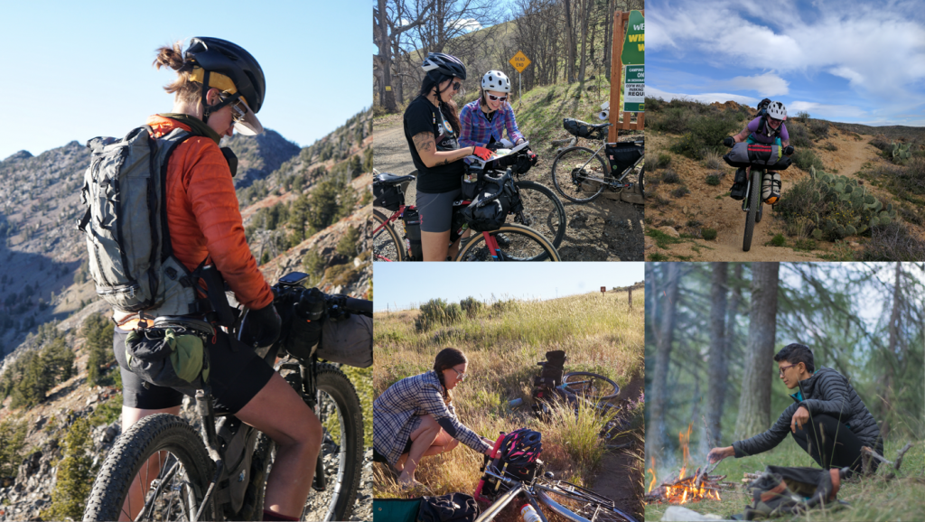
See the Past Rides
From March 2019 to March 2020, ride leaders organized self-supported adventure rides in their local communities. Take a look at the past rides and routes to get inspired for your next trip!
SAN MARTIN, CA
Dates: March 14th – 15th 2020
Organizer: Julia Engle (She/They)
Difficulty Level: Intermediate
Route: https://ridewithgps.com/routes/31911785
Contact: julia4blue@gmail.com
Join us for a weekend riding the steep fire roads and bumpy singletrack that traverse the territory of the Yokut and Ohlone people within the current boundary of Henry W. Coe State Park. This ride is for womxn, trans, femme, & non-binary folks only and due to park policy, the group is limited to 8 people.
Weather permitting, we will explore some of the more remote sections of the park in this two-day, one-night bikepacking trip. Highlights will include early spring wildflowers, waterfalls, creek crossings, epic vistas, and camping by an isolated pond. A mountain bike is recommended (or at least 2” knobby tires) and there will be several loose and rocky hike-a-bike sections. The route is a total of 50 miles and 8,600 feet of elevation gain. The riding is split evenly between the two days.
ANZA BORREGO DESERT STATE PARK, CA
Dates: February 15th – 17th 2020
Organizer: Susie (She/Her)
Difficulty Level: Intermediate
Route: https://ridewithgps.com/routes/32173676
Contact: vsusannahlowber@gmail.com
This route travels through the Carrizo Badlands and Pinyon Mountain Valley regions of Anza Borrego Desert State Park. Get ready for a rich variety of geological wonders as this route winds through ancient sea beds and carved canyons. Some highlights include Hahapa Flats, Sandstone Canyon, Split Mountain, Arroyo Tapiado Mud Caves, Wind Caves, Canyon Sin Nombre and Mountain Palm Springs. The route is 40% paved 60% dirt with 1% of hike a bike. We will ride 86 miles with 6000 ft of elevation total over 3 days. The camping is primitive and there are no food or water resources after our lunch stop day 1. Everything will have to be packed in and out.
CHATTANOOGA, TN
Dates: November 16th-17th
Organizer: Alea Coble (she/her), Jen Clemmer (she/her/they/them)
Difficulty Level: Intermediate
Route: https://ridewithgps.com/routes/30111421
Contact: rtr555@mocs.utc.edu
“Lookout, It Gets Better” is a ride for folks who are into a sweet coasty fun time reward after a climb up Lookout Mountain. Loop from Whole Foods parking lot in downtown Chattanooga to Cloudland Canyon State Park and back. It is 81 miles (Day 1: 37, Day 2: 44). Features: mostly road, some gravel, and about a 1.5 miles of single track. 2 big climbs the first day. First one gains 1200 ft over 7 miles of gravel. The second, 500 ft over 4 miles of paved road. First day: gravel and road climbs. Single track leads into the park. Options along the way for snacks, food, and water (local pizza, burritos, cafes). Camping at scenic state park with amenities. Second day: 5 mile descent on paved road. Route rolls through the Chickamauga Battlefield National Military Park and back to Whole Foods. Expect autumnal deciduous forests, mountain views, and rolling pastoral landscape.
ARIVACA, AZ
Dates: November 1st-3rd
Organizer: Brenda Croell (she/her), Monique Laraway (she/her/they/them)
Difficulty Level: Beginner
Route: https://ridewithgps.com/routes/30248768
Contact: brendacroell@gmail.com, outcycle@gmail.com
This 60-70 mile route with around 5800 feet of elevation gain goes through Tohono O’odham land and will begin in Arivaca, Arizona. We recommend organizing carpool options from Tucson, Arizona, which is about an hour drive. For this ride, we recommend bringing a tent as there are a limited amount of trees for hammock setups. We also recommend carrying around 3-4 liters of water. The first day will consist of a 20 mile ride beginning on a paved road out of Arivaca and quickly transition to rugged unmaintained dirt roads through the Coronado National Forest. We will bike up and over hills dotted with various cacti species and cattle. The second day will be approximately 20 miles with a long break at Pena Blanca Lake. This day will include a steep climb with rewarding views of high desert valleys. We will stop at the lake for water refills and swimming before back tracking to our campsite with views of beautiful rockscapes. The third day we will return to Arivaca Lake (20ish miles) for our final camping destination and/or optional return to Arivaca for folks who need to head home early.
Must Know: This route passes through an area with high amounts of border crossings by those seeking asylum and refuge. There will be border patrol along the route. In lieu of a camping fee, please consider donating to No More Deaths/No Más Muertes.
HOOSIER NATIONAL FOREST, IN
Dates: October 11th – 13th
Organizer: Queer Bike Magic – Evie Heflin (she/her) and Nern Ostendorf (she/they)
Difficulty Level: Beginner
Route: https://ridewithgps.com/routes/30338192
Contact: evieheflin@gmail.com
This 3-day ride in Hoosier National Forest, located on Piankeshaw and Shawnee lands, will allow riders to choose their own adventure, selecting between short and moderate daily routes. This laid-back trip is for those who want to cruise into fall experiencing serene hardwood forests and local wildlife. The majority of the ride will take place on mixed surface roads with rolling hills and the occasional larger climb/descent. We are all about camp vibes on this trip so feel free to bring your banjo or favorite campfire recipe. After riding around the national forest’s northern corridor, the trip back to our vehicles will include a stop at one of Monroe Lake’s many beaches. We will be using established backcountry campsites with limited access to potable water, bathroom facilities, and trash receptacles. A car with water and emergency supplies will be parked near the Hickory Ridge Fire Tower during the ride.
WASCO, OR
Dates: October 11th – 13th
Organizer: Carley (she/they)
Difficulty Level: Intermediate
Route: https://ridewithgps.com/routes/30438980
Contact: carleyrenae@gmail.com
This 134-mile route with 9,419 feet of elevation travels through the high desert on Confederated Tribes of Warm Springs, Wasco & Wishram, and Tenino land via gravel roads and some pavement. 35-40c tires are recommended for the terrain. We will ride 40 miles on Friday to our camp spot at a city park in Dufur. Camp will be near a market. Saturday we will pass stores in Tygh Valley and Maupin, and ride 41 miles total to Oak Springs campground. Sunday we will ride 53 miles back to the Deschutes River Recreation Area. The last 40 miles are known for strong headwinds. The start of the route is a 2-hour drive from Portland, so carpooling is encouraged. If folks are interested, we can camp at the Deschutes State River Recreation Area on Thursday night.
BIG SUR, CA
Dates: October 10th – 13th
Organizer: Sara Wainer (she/her)
Difficulty Level: Intermediate
Route: https://ridewithgps.com/routes/30430167
Contact: Sara.Wainer@specialized.com
Join Specialized and WTF Bikexplorers for an epic loop around the Big Sur mountains!
This four-day, three-night self-supported bikepacking trip will take us from Monterey down Highway 1, up and over Nacimiento-Fergusson Road, through oak grasslands, and down a long dirt road descent to the Arroyo Seco river. We finish by heading back up the east side of the Santa Lucia mountains to Monterey. This is one of the most vaunted routes in Central CA with ocean views, redwoods, huge oak trees, and deep swimming pools of the Arroyo Seco River. The 170 mile route with a combined 15000’ of climbing will have its longest day top out at 60 miles, and the shortest day is just 14 miles with plenty of time for resting at the Arroyo Seco river! The route is estimated to be 90% paved and 10% dirt, but many of the roads are deep in the Santa Lucia mountains so we won’t be seeing too many cars once we get off Hwy. 1. An October start date means fewer cars, cooler day temps, and the river should still be swimmable.
This ride is for women, trans, femme, & non-binary folks only. Event cap is 12 riders.
SAN DIEGO, CA
Dates: October 5th – 6th
Organizer: Beth Farrell (she/her)
Difficulty Level: Intermediate
Route: https://ridewithgps.com/routes/30430206
Contact: simplythebethst@gmail.com
This will be a coastal ride on all paved terrain, a few steep climbs along the way but fairly manageable for most bikes with gears. Not super wilderness – there will be traffic along the way, but camping out at San Elijo State Beach for a salty splash at the end of the day. Returning via the same route – which the GPS link doesn’t show, but there and back ~ 50 miles. Aiming for a fun and inclusive community vibe.
SEATTLE, WA
Dates: September 21st – 22nd
Organizer: Carol Camilleri
Difficulty Level: Beginner
Route: https://ridewithgps.com/routes/30528991
Contact: carol.l.camilleri@gmail.com
Go to the far East (of King County) and get out of town on this mostly separated path/gravel path to Tolt MacDonald Park. We’ll stay at hiker/biker sites and share stories from the saddle and s’mores galore.
PUGET SOUND, WA
Dates: August 31st – September 2nd
Organizer: Jess Kim (She/They)
Difficulty Level: Intermediate
Route: https://ridewithgps.com/routes/30563477
Contact: jesskim1221@gmail.com
Tour the Puget Sound with this two-night trip up to the mighty San Juan Islands and back on the mainland to a former military fort that has been repurposed for so many activities. The ride will be mostly pavement, but look around for sweeping vistas of the big Blue and Olympic Mountains. Camping will be at state parks at hiker/biker sites with access to potable water. Ride time will be long, about 7 hours of saddle time max. on Day 1 for up to 70+ miles. Riding will get easier by Day 2 and 3, so we may stop to pick up treats along the way.
SAN FRANCISCO, CA
Dates: August 31st – September 2nd
Organizer: Melissa Sweet (she/her)
Difficulty Level: Intermediate
Route: https://ridewithgps.com/routes/30430167
Contact: melissa.evesweet@gmail.com
If you identify as a female, trans, femme, butch, gender-non-conforming, and/or non-cis male person eager to get sweaty and pedal with camping gear strapped to your bike, then this ride is for you! This 3-day, 2-night ride will have you cycling over the Golden Gate Bridge, sleeping amongst redwoods, swimming in a watering hole, and pedaling along the bay coastline. It is approximately 80 miles with a combined 3,500 ft of climbing. The path is mostly paved and shared with cars, with 5 miles of optional gravel riding. Plenty of stops along the way will ensure we are well fed and energized to tackle each leg of our journey.
VASHON ISLAND, WA
Dates: August 10th – 11th
Organizer: Jess Kim (She/They)
Difficulty Level: Intermediate
Route: https://ridewithgps.com/routes/30439091
Contact: jesskim1221@gmail.com
Ride the rolling hills of Vashon Island in the Puget Sound of Washington. Across the water you’ll see the towering Olympic Mountains, and the skyline of Seattle from afar. The ride will be mostly pavement with some stretches of gravel path at parks and wooded trail at camp. The campsite at Maury Island Marine Park is primitive so pack everything you need for an overnighter without access to food or running water.
BURLINGTON, VT
Dates: July 26th – 29th
Organizer: Christine Hill (she/her)
Difficulty Level: Intermediate
Route: https://ridewithgps.com/routes/296065956
Contact: christine.tyler@gmail.com
We depart Burlington after work on Friday and ride 27 miles on mostly paved and unfortunately well-trafficked roads to Underhill State Park (largely mellow with the exception of 900ft of climbing packed dirt in the last 2 miles to camp). Saturday consists of 55 miles of rolling gravel and backroads with 14 miles of flat rail trail in the middle of the day. Saturday offers endless swimming opportunities, general stores for snacks and water, and a final stop at the famed Hill Farmstead Brewery before riding to a nearby primitive campsite on Long Pond. On Sunday we’ll arrive in the crunchy hamlet of Glover mid-morning, and the group will split: those who want to attend Bread & Puppet’s Sunday pageant at 3pm will have either arranged for rides home in the evening (shuttle maybe? TBD) or have plans to ride back on Monday, while advanced riders who wish to get back to Burlington that evening will embark on their 88 mile journey — after a fresh donut at Red Sky Trading post, of course.
MAYBELL, CO
Dates: June 13th – 17th
Organizer: M Waldron (they.them)
Difficulty Level: Beginner
Route: https://ridewithgps.com/routes/29606593
Contact: em.waldron@gmail.com
I’ve been dreaming of this ride for years as I learned the roads and terrain here while inspecting oil and gas activities in the area. This ride is designed to expose the rider to the incredible sedimentary geology of NW Colorado while also exposing them to the many ways we use, develop, and extract in this wild land. The final 10 miles are on the famous Great Divide Route and our final night will be at Brush Mountain Lodge. Mostly on maintained county roads, with the longest day being 43 miles, and the only hike-a-bike happening on the first day, this ride is designed for beginning-advanced bike packers and those who are curious about NW Colorado and the history of extraction and exploration here. There will be transportation back to Hayden, CO available from Brush Mountain Lodge after night 4.
BRISTOL, U.K.
Dates: June 1st – 2nd
Organizer: Katherine Moore (she/her)
Difficulty Level: Beginner
Route: https://ridewithgps.com/routes/29700940
Contact: katherinemoore44@hotmail.co.uk
The Mendips Area of Outstanding Natural Beauty is just a stone’s throw away from the bustling city of Bristol, yet it offers some of the most spectacular and diverse riding in the South West of England, from quiet back lanes to flowy dirt singletrack, sheltered pine forests to exposed and beautiful purple moorlands. The route heads out from Business As Usual, a cycling hub in central Bristol, on lanes and bridleways to this remote gem where we’ll wild camp overnight in ancient woodlands, before returning to the big city the following afternoon. The second day will take us to the incredible Cheddar Gorge, a must for cycling routes in the area, with an alternative climb up this wild landscape. The off road sectors will be mellow to medium difficulty, with the occasional steep incline ( we do love a bit of hike a bike) which is perfect for inexperienced off-road riders.
REDFERN, NSW, AUSTRALIA
Dates: May 11th – 12th
Organizer: Rachel Hayden (she/her)
Difficulty Level: Intermediate
Route: https://ridewithgps.com/routes/29700896
Contact: contact@omafiets.com.au
Women & gender diverse folk are welcome to join this overnight bikepacking trip from Wentworth Falls Station to , and the out to Woodford the following day (or on to Glenbrook if you’re feeling adventurous!).
Distance: 20km per day
Terrain: 100% fire trail
MICHAUX STATE FOREST, PA
Dates: April 5th – 8th
Organizer: RAR Fingerlakes
Difficulty Level: Beginner
Route: https://ridewithgps.com/routes/28916790
This is a three day ‘beginner plus’ route on fire roads through Michaux State Forest roads in south central Pennsylvania: we’ll be on Haudenosauneega Confederacy and Susquehanna lands. The route consists of long, gradual climbs and fast, fun descents. We’ll ride through the northern terminus of the Blue Ridge Mountains through oak-pine and oak-hickory forest and across many streams that drain into the Potomac River and Chesapeake Bay. Camping occurs at primitive backcountry sites that’ll likely offer privacy but will have no running water, toilets, or trash disposal. We’ll be riding through the mountains, so there’ll be a fair amount of elevation, but climbs will be gradual (mostly <10% grade). We recommend tires at least 45mm in width for comfort and safety on the gravel, which is mostly smooth but very potholed in some areas. *Due to low temperatures in the mountains, this ride will be cancelled if the forecast calls for long periods of rain.
WASHINGTON D.C.
Dates: April 13th – 14th
Organizer: RAR Fingerlakes
Difficulty Level: Beginner
Route: https://ridewithgps.com/routes/29606592
Contact: dgparnes@gmail.com
Come explore the C&O towpath on a W/T/F overnighter specifically designed for beginners and first timers! We’ll bike together alongside the canal, eat and share allll the snacks, and camp with a beautiful view of the Potomac.
Saturday we’ll ride 4 miles from D.C.’s Union Station to the C&O trailhead, then 11.5 miles on the dirt and crushed gravel trail to our campsite. Sunday we’ll turn around and ride the same route back. The route is almost entirely on bike lanes from the station to the trailhead, then completely car-free on the trail. The elevation gain is minimal, making this a great route for first timers! While close to D.C., the forested route and secluded campground provide an escape into nature.
SIDNEY, B.C. CANADA
Dates: April 19th – 21st
Organizer: Kai Conradi (he/him)
Difficulty Level: Intermediate
Route: https://ridewithgps.com/routes/29613071
Contact: kaiivor@shaw.ca
This three-day ride will take us from Victoria to two of BC’s largest Gulf Islands: Galiano and Saltspring. We will be riding and camping on the lands of the Songhees, Esquimalt, WSÁNEĆ, Tsawwassen, Stz’uminus and the Hul’qumi’num Treaty Group peoples. The total distance is 175km with an elevation gain of 1820 metres. Because we’ll be on a different island each night, it’s easy to join just for one night if you can’t make it for both.
The Gulf Islands are notoriously hilly, but the hills, for the most part, are rolling, with lots of nice descents. The ride will be almost entirely on paved roads (with a few brief gravel/dirt sections near our camp spots), through lush forest and along stunning coastlines. Traffic on the islands is minimal (except on the main road on Saltspring around ferry times). We will be camping in two provincial parks, both of which border on the ocean with great swimming and stargazing. The trip involves three ferry rides. On day three, there is the option to do a longer ride back (about 100km), which would involve taking an additional ferry.
HOBART, TAS, AUSTRALIA
Dates: April 19th – 29th
Organizer: Tyla Bickley & Suzie Mukasaus(she/her)
Difficulty Level: Intermediate
Route: https://ridewithgps.com/routes/29613071
Contact: tyla.bickley@hotmail.com
The Tasmanian Trail is a long-distance multi-use trail in Tasmania. It links small villages by trails and country roads. The island state is known for its natural beauty, wildlife and awesome fresh produce. This route aims to take in the best of these aspects. Our ride will leave from Hobart, and pick up the Trail in Judbury (due to southern sections being closed for fire damage). While daily distances are very manageable (~50km), on many days there will be some tough elevation gains (+1000m). It passes through dense forest and open plateaus, heading north through the Central Highlands to finish in Devonport. There are bush campsites along the way, and we will be passing through many small villages to restock and refuel along the way.
Learn more about the trail on Bikepacking.com